
Wageningen University (coordinator)
Contact person: Bas Pedroli
Provincie Zuid-Holland
Contact person: Isolde Somsen
![]()
![]()
- New third parties will join during the constitution of local networks/consortia in the Pilot Landscapes
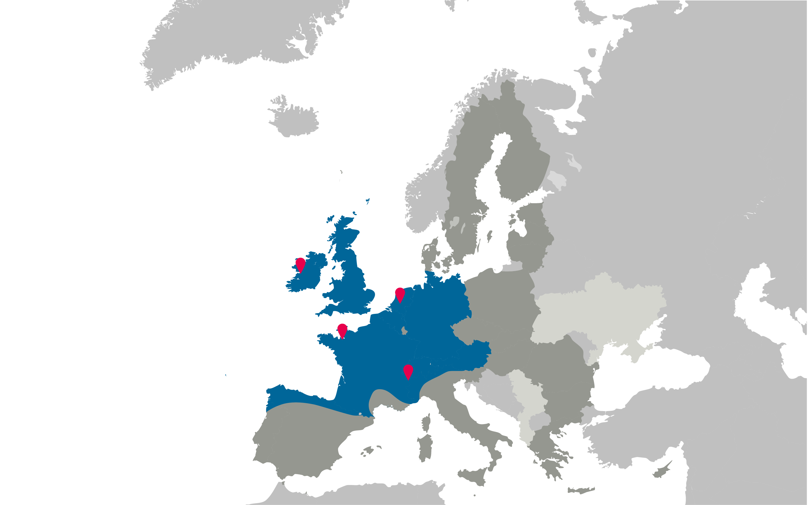
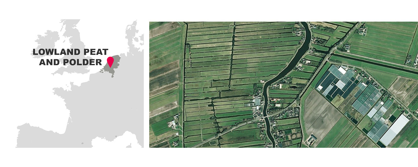
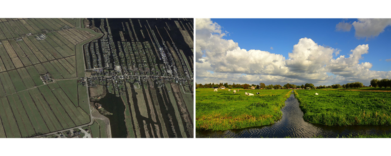
Lowland peat and polder (Netherlands)
The Lowland Peat and Polder Pilot Landscape located in the Heart of Holland and is characterized by its rural character that contrasts the urban areas around it. Agriculture, nature and recreation are the primary activities in the area. Since the Dutch Golden Age (17th Century), there has been a ring of cities surrounding this green and open central area of wet meadows and marshland. These peaty wetlands were not suitable for building but instead were used for dairy (Gouda cheese!). Peat oxidation leads to soil subsidence requiring increased drainage leading to further peat oxidation, which is further aggravatedby Climate Change.
LOCAL NETWORK OF STAKEHOLDERS:
- Landscape Observatory of the Netherlands:
- Gerrit-Jan van Herwaarden
![]()
- WATERSCHAP RIVIERENLAND:
- Daan Willems, [email protected]
![]()
- PROVINCE ZUID HOLLAND:
- Isolde Somsen [email protected]
- Werncke Husslage [email protected]
- Caroline Ammerlaan [email protected]
![]()
OUTPUTS / RESULTS:
1 . Local Network +Work plan
+ AELCLIC_WP3_Zuid-Holland_WORKSHOP1_Report - ENGLISH (.PDF)
2 . Co-identified Impacts and Opportunities + Structure and Contents for a LACAP -
+ AELCLIC_WP3_Zuid-Holland_WORKSHOP2-3_Report - ENGLISH (.PDF)
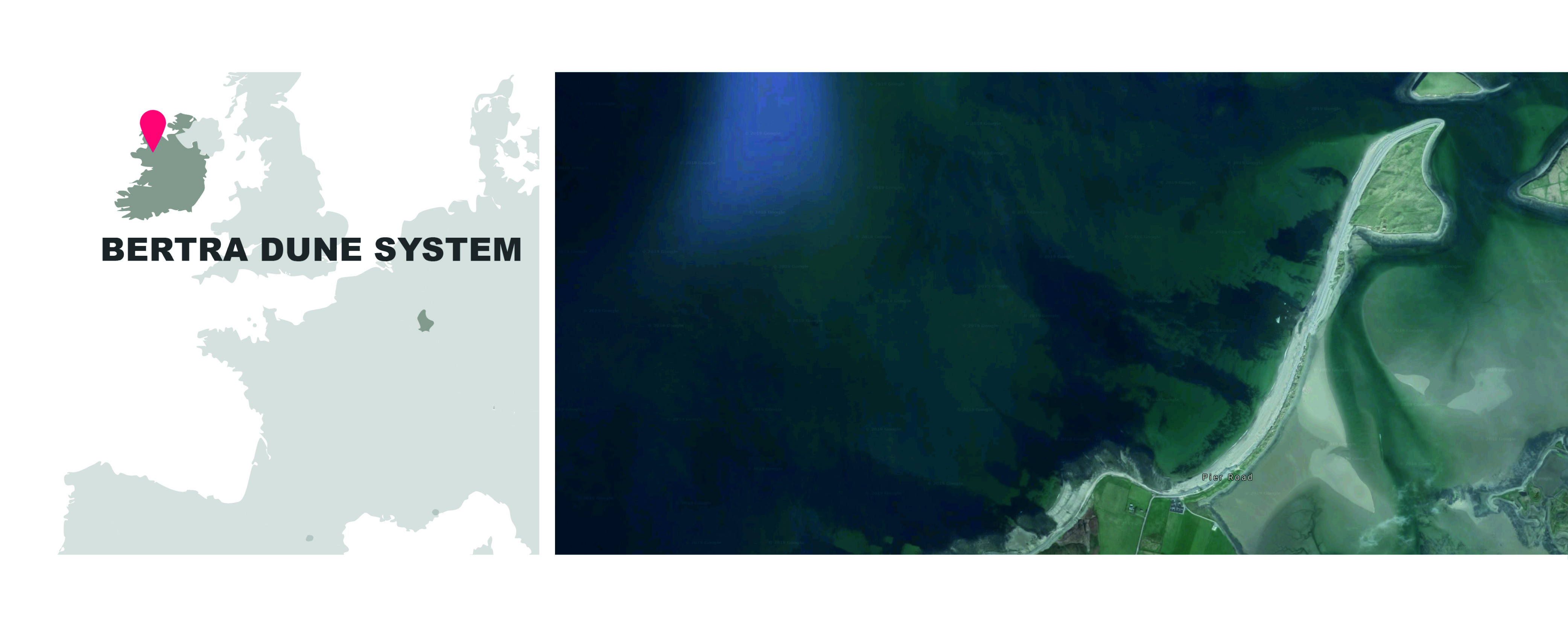
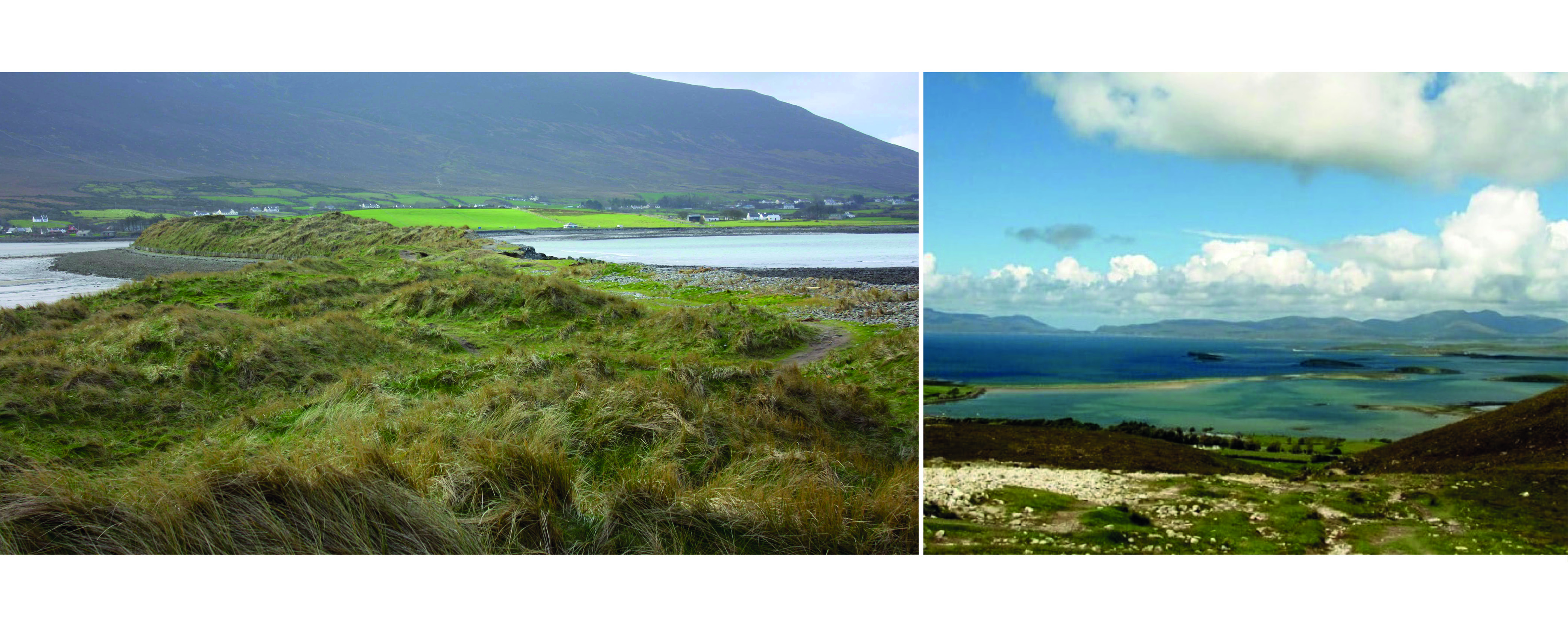
BERTRA DUNE SYSTEM (County Mayo, Ireland)
The vision of the AELCLIC-project for the Bertra Pilot Landscape is to create a forum for the integrated management of Bertra Strand and its surrounding landscape. The included beach-dune system is in a precarious state, with multiple pressures including climate change threatening its long-term future. The project is engaging local communities and stakeholders, local and national authorities and the academic community in a joint approach to managing and planning for this valuable landscape in the face of climate change
LOCAL NETWORK OF STAKEHOLDERS:
Climate Action Regional Office
Mr David Mellet, [email protected]
Murrisk Development Association
Ms Jo Ortelli, [email protected]

NUI Galway, Geography Department
Dr Kevin Lynch, [email protected]
![]()
National Parks & Wildlife Service
Mr Eoin McGreal, [email protected]
OUTPUTS / RESULTS:
1. Local Network + Co-identified Impacts and Opportunities
+_AELCLIC_WP3_Bertra_IRELAND_WORKSHOPs1&2_Report - ENGLISH (.PDF)
+_AELCLIC_WP3_Bertra_PUBLIC VERSION_Report WORKSHOPs1&2 - ENGLISH(.PDF)
2. Structure and Contents for a LACAP -
+_AELCLIC_WP3_Bertra_PUBLIC VERSION_Report WORKSHOP3 - ENGLISH(.PDF)
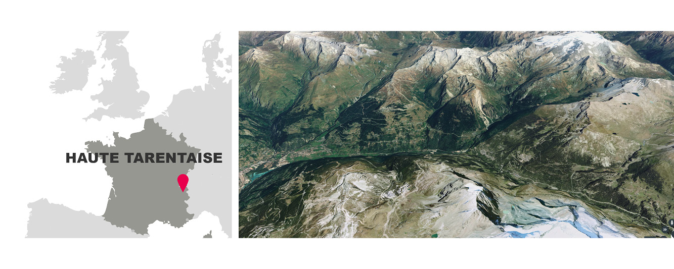
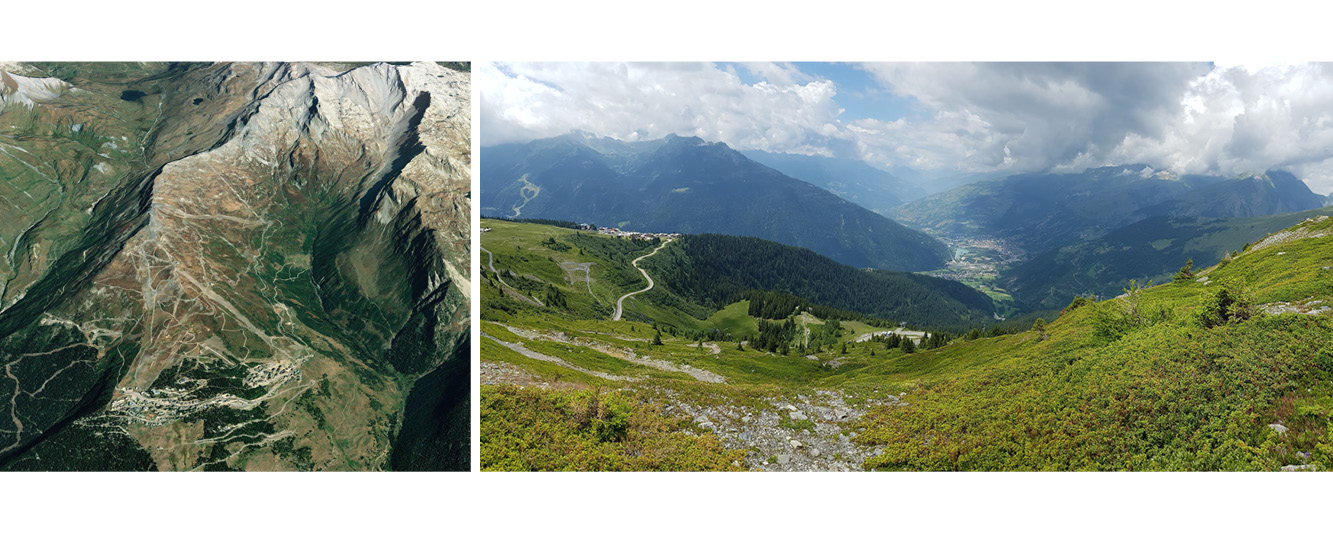
Haute Tarentaise valley (France)
The Tarentaise Valley is a valley of the Isère River in the heart of the French Alps, located in the Savoy region of France. With altitudes ranking from 800m to 3779m; The Haute Tarentaise valley spreads over 8 communes and 50km: Bourg Saint Maurice-Les Arcs, Les Chapelles, Montvalezan-La Rosière, Sainte Foy Tarentaise, Séez, Tignes, Villaroger and Val d’Isère. This vast mountain territory bordering Italy, has forged its identity and culture thanks to its geographical location on the borders of 4 mountain massifs. Due to its alpine climate the valley is highly exposed to Climate Change effects. At the same time the valley offers a perfect area for a discussion on Climate Change adaptation due to the presence of lots of actors and activities, the high diversity of its landscape, the presence of many small villages with lots of stakeholders and the dynamic and entrepreneur character of its population
LOCAL NETWORK OF STAKEHOLDERS:
- VAL D’ISERE FOUNDATION
- Emeline Daumard, [email protected]
![]()
OUTPUTS / RESULTS
1 . Local Network + Co-identified Impacts and Opportunities
+ AELCLIC_WP3_Haute Tarentaise_WORKSHOP1-2 Report - ENGLISH (.PDF)
2 . Structure and Contents for a LACAP -
+ AELCLIC_WP3_Haute Tarentaise_WORKSHOP3 Report - ENGLISH (.PDF)
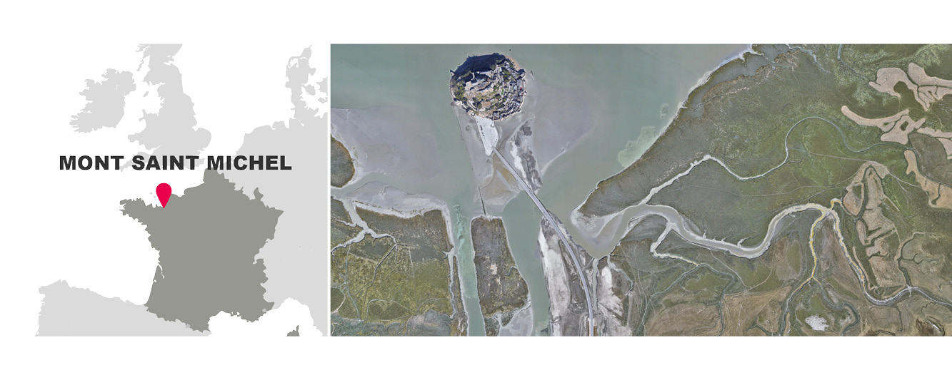
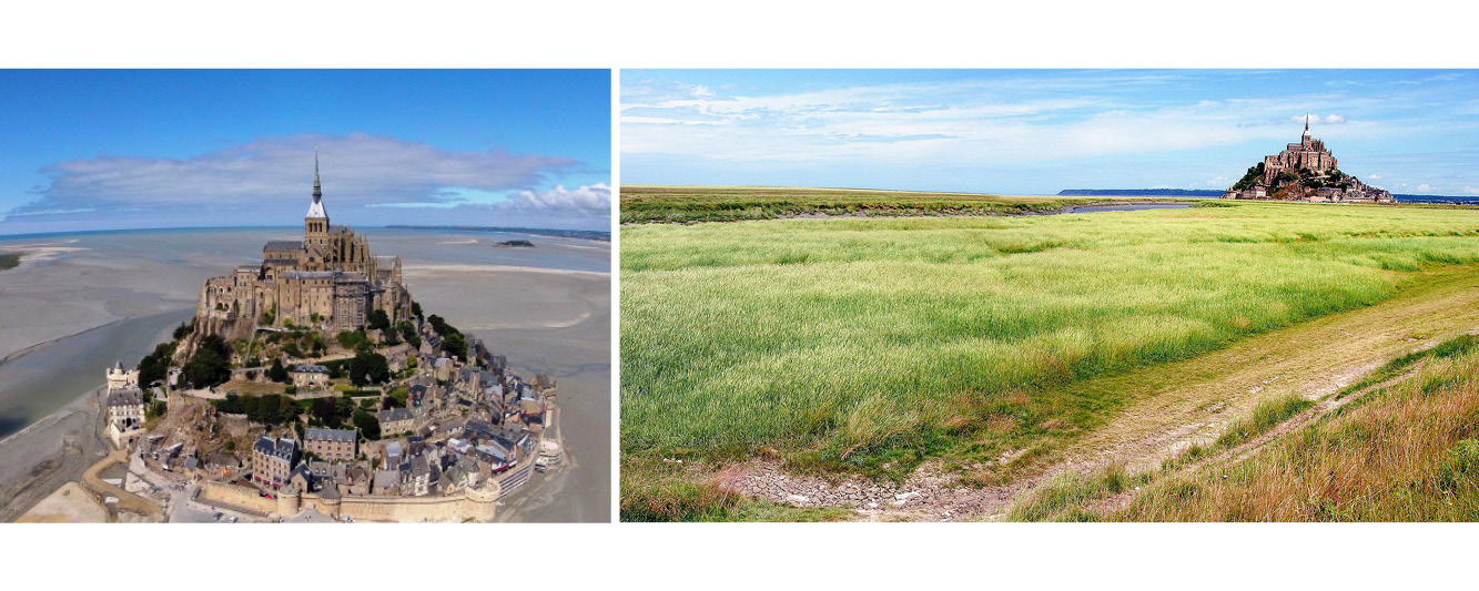
Mont Saint Michel (France)
[…]
LOCAL NETWORK OF STAKEHOLDERS:
we will add here after the WORKSHOP1 the names, logos and contact of each local organization participating in the local network/consortium
OUTPUTS / RESULTS:
- Local Network and Work Plan - (expected in May 2019)
- Co-identified impacts and opportunities + Initial structure and contents for a LACAP (Landscape Adaptation Plan) - (expected in September 2019)
- Structure and Contents for a LACAP + Climate Change Agreement - (expected in November 2019)