
Alma Mater Studiorum - Università di Bologna
Climate KIC partner
Contact person: Daniele Torregianni
Comune di Bologna
Climate KIC partner
Contact person: Giovanni Fini
Fondazione per l’Innovazione Urbana
Climate KIC partner
Contact person: Valeria Barbi

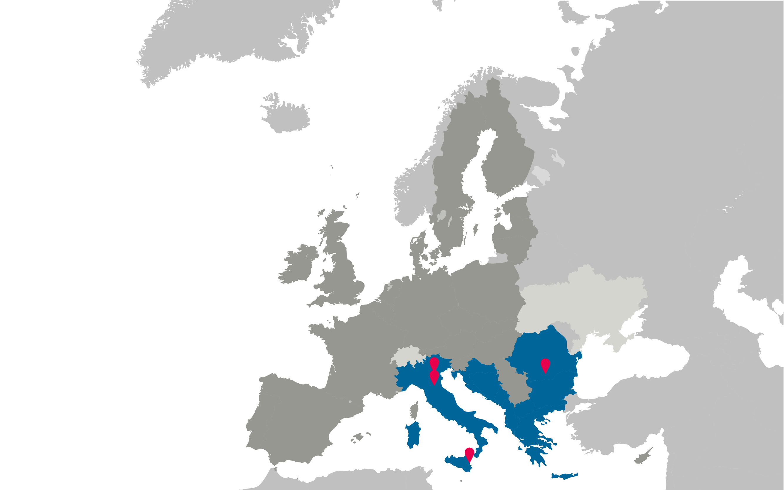
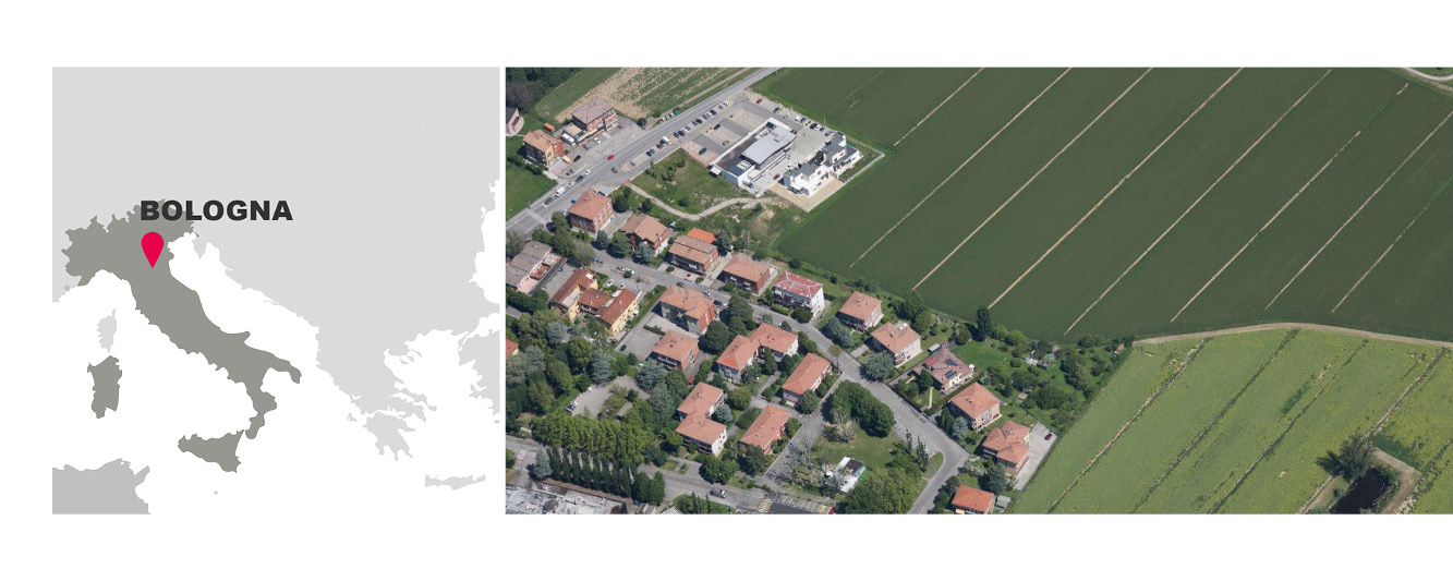
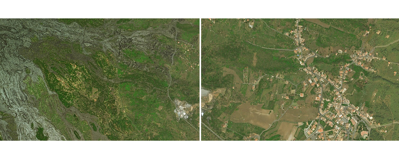
North-eastern fringe areas of the municipality (Bologna)
The Pilot Landscape of Bologna is a fringe region including a wide collage of periurban land uses: residential areas, green areas and community gardens, agricultural areas and farms, food industries, shopping/business parks, university campus, mobility infrastructures, leisure/tourism activities related to the agri-food sector. Development is planned in a portion of the agricultural areas of the pilot. This pilot thus offers the opportunity to address a wide range of challenges related to the impacts of climate change on many sectors, including those relevant for landscapes waiting for transformations, where both (even long) transition phases and developed scenarios have to be considered.
Area: about 23 square kilometres (2.300 hectares)
Credits: archives of the Municipality of Bologna (Sistemi Informativi Territoriali http://dru.iperbole.bologna.it/cartografia/archivio-cartografico)
LOCAL NETWORK OF STAKEHOLDERS:


![]()


![]()
![]()
![]()


● Giuseppe De Togni, Comune di Bologna
● Julia Colver, Nomisma
● Marco Spinedi: interporto Bologna
● Marco Caliceti: Confagricoltura Bologna
● Claudio Cervellati, Confagricoltura Bologna ed Emilia Romagna
● Marco Alberghini UGC Cisl Area Metropolitana Bolognese
● Michele Solmi: Consorzio Bonifica Renana
● Andrea Morsolin: Consorzio Bonifica Renana
● Stefano Savini: Emilbanca
● Silvia Bergami: EmilBanca
● Marco Odaldi: AESS (Agenzia Energia e Sviluppo Sostenibile) Modena
● Patrizia Preti: Orti di Via Salgari, ANCESCAO
● Andrea Bruini: Granarolo Group
● Lucia Fresa: Agenzia del Pilastro
● Francesco Palmieri: Bologna Welcome
● Carmine Preziosi: ANCE Bologna (Collegio Costruttori Edili)
● Chloy Vlamidis, Agenzia di Sviluppo Pilastro
OUTPUTS / RESULTS:
1. Local Network and Work Plan & Co-identified impacts and opportunities + Initial structure and contents for a LACAP (Landscape Adaptation Plan)
+ AELCLIC_WP5_Bologna_WORKSHOP1_REPORT_16.05.2019 - ENGLISH (.PDF)
+ AELCLIC_WP5_Bologna_WORKSHOP1_PUBLIC SUMMARY
2. Structure and Contents for a LACAP + Climate Change Agreement -
+ AELCLIC_Report_Workshop_Bologna_18.09.2019 - ENGLISH (.PDF)
+ AELCLIC_WP5_Bologna_WORKSHOP2_PUBLIC SUMMARY
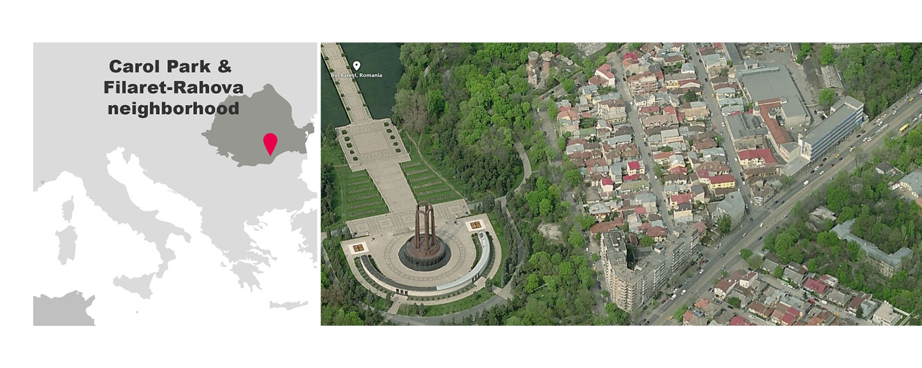
Carol Park and the Filaret-Rahova neighborhood (Bucharest)
Carol Park and the Filaret-Rahova neighbourhood represent a protected area in the South-West Bucharest. The area’s strong industrial heritage, together with Bucharest’s struggles with air pollution and increasing summer temperatures, make Filaret-Rahova an interesting case for studying climate change impacts in urban fringes and possible adaptation solutions.
Area: about 43 hectares.
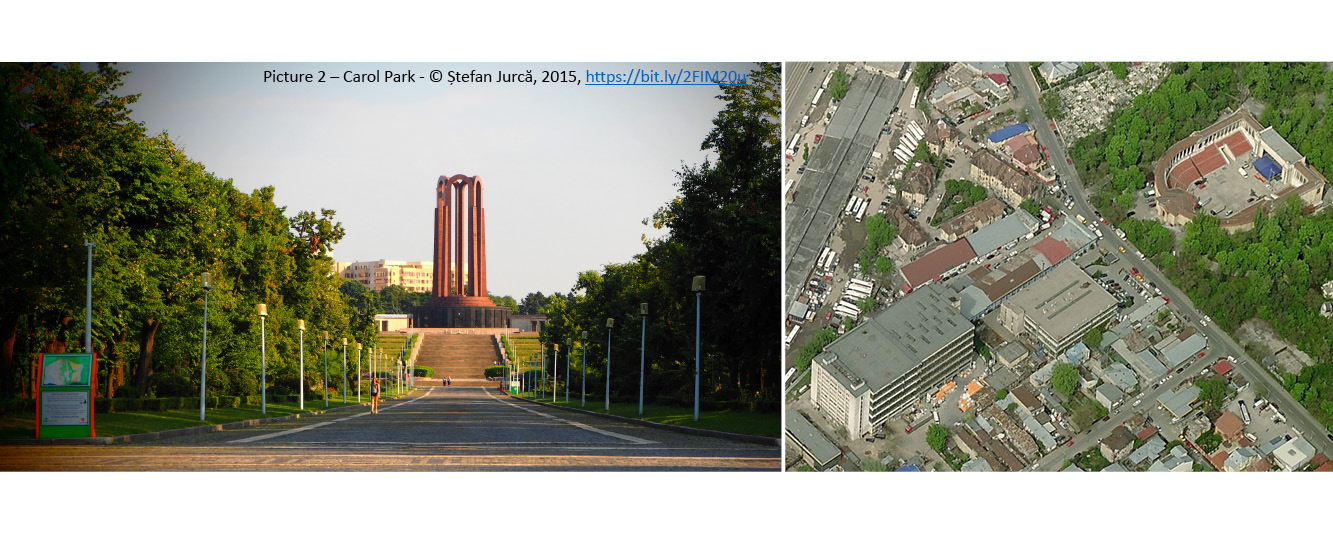
Carol Park - © Alexandru Panoiu, 2016, https://bit.ly/2FUtnA9
LOCAL NETWORK OF STAKEHOLDERS:
![]()
- URBASOFIA S.R.L
- Contact: Pietro Elisei [email protected]

- Arche association
- Alexandru Mexi [email protected]
![]()
OUTPUTS / RESULTS:
1. Local Network + Co-identified Impacts and Opportunities + Structure and Contents for a LACAP:
+ AELCLIC_WP5_Report_Workshop_Bucharest - ENGLISH (.PDF)
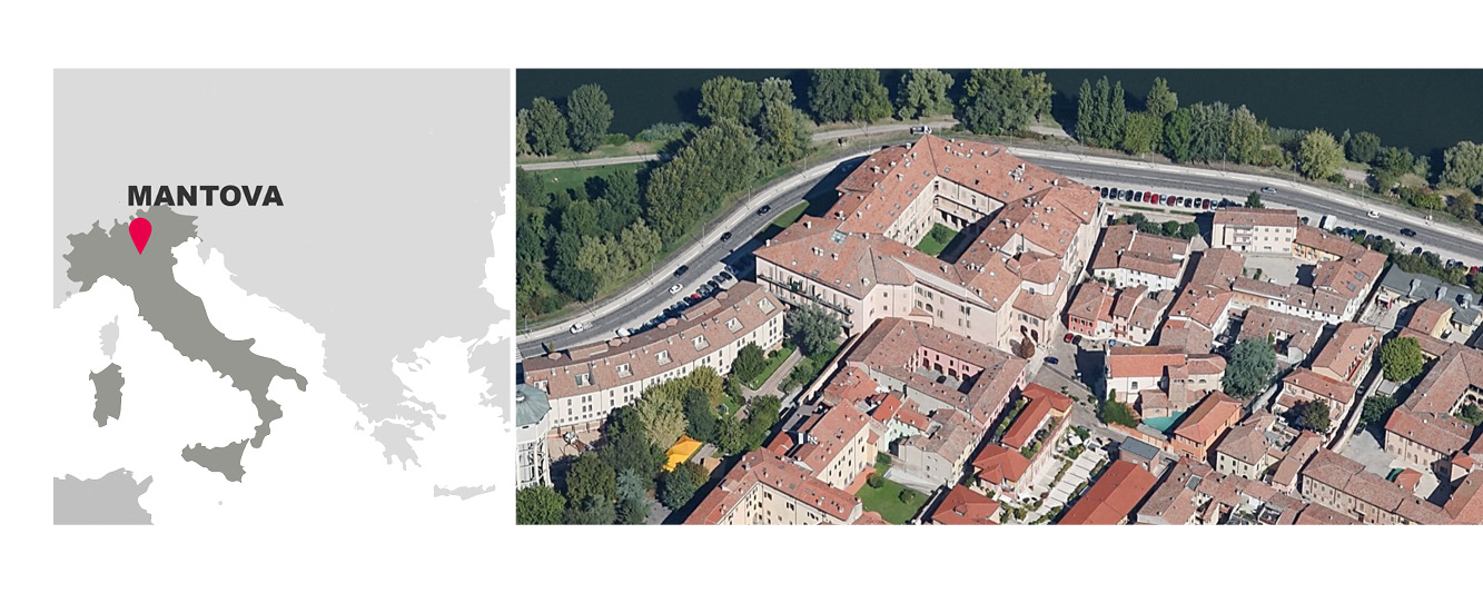
Mantova
The Municipality of Mantua is located in the south-eastern sector of the Lombardy region, along the Mincio river that runs from north to south in the Po Valley. The Mantua border touches the regions of Lombardy, Veneto and Emilia-Romagna. The city is registered as a UNESCO site under the name “Mantova e Sabbioneta” and has unique architectural and landscape features both from a historical and naturalistic point of view. IUAV University of Venice was appointed by the municipal administration in November 2017 for the preparation of the “Guidelines for the Climate Adaptation Plan”, a document completed in November 2018.
LOCAL NETWORK OF STAKEHOLDERS:

![]()

![]()
![]()

![]()
● Anna Marson, University IUAV di Venezia:
● Gabriella Montanarini, Municipality of Mantova
● Sandra Savazzi, Municipality of Mantova
● Elisa Parisi, Municipality of Mantova
● Monica Bedini, Municipality of Mantova, UNESCO office
● Giulia Moraschi, Municipality of Mantova
● Marcella Ghidoni, Municipality of Mantova
● Iva Tiziana Silvestrin, Municipality of Mantova
● Roberta Marcacciaro, Municipality of Mantova
● Francesca Paini, Municipality of Mantova
● Stefano Pasquali, Province of Mantova
● Renzo Bonatti, Province of Mantova
● Cristiano Guernieri, Architects Professional Association of Mantova
● Cristina Alinovi, Centro Studi PIM (MI)
● Simone Massari, Mantova Ambiente, gruppo TEA Spa
● Sandro Sutti, Labter Crea Mantova
● Monica Viviani: “Gazzetta di Mantova”
● Fausto Ugozzoli, Aerodron Srl
● Edoardo Tolasi, Ordine Agronomi forestali,
● Luisa Pedrazzini, Lombardy Region
OUTPUTS / RESULTS:
1. Local Network and Work Plan
AELCLIC_WP5_Mantova_WORKSHOP1_REPORT_13.05.2019 - ENGLISH (.PDF)
2_AELCLIC_WP5_Mantova_WORKSHOP1_PUBLIC SUMMARY
2. Co-identification of Climate Change Impacts and Co-definition of key contents of a Landscape Adaptation Plan to Climate Change
AELCLIC_WP5 Mantova WORKSHOP2 REPORT 16.07.2019 - ENGLISH (.PDF)
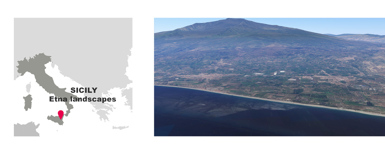
Southeastern part of the Etna landscapes (Sicily)
The area includes the municipalities of Aci Castello, Acireale, Giarre, Riposto, Mascali, Fiumefreddo, and Calatabiano. Many of them are important urban centers and exceed, in total, 140,000 inhabitants. The pilot is located in the Southeastern side of the Etna volcano, in the Sicily Region. The climate of the area is Mediterranean. In the area of Giarre and Mascali, microclimate peculiarities lead to annual precipitation values higher than the other municipalities.
Area: total extension of about 166 Km2
LOCAL NETWORK OF STAKEHOLDERS:
![]()
- FONDAZIONE PICCOLO DI CALANOVELLA
- Michele Germanà, [email protected]; [email protected]
![]()
- AGENZIA PER IL MEDITERRANEO
- Michele Germanà, [email protected]
![]()
- ETNA GARDEN CLUB
- Cosentino & Maria Carmela Vagliasindi. [email protected]

- FONDAZIONE RADICE PURA
- Giusi Monti & Luca Gangemi, [email protected]; [email protected]

- ASSOCIAZIONE MUSICALE ETNEA
- Luca Recupero, [email protected]

- InArch SICILIA
- Ignazio lutri, [email protected]
![]()
OUTPUTS / RESULTS:
1 - Local Network + Co-identified Impacts and Opportunities + Structure and Contents for a LACAP:
+ AELCLIC Report Workshop Etna-Pilot 19.07.2019 - ENGLISH (.PDF)